California Undersea Imagery Archive
SFML Data Library

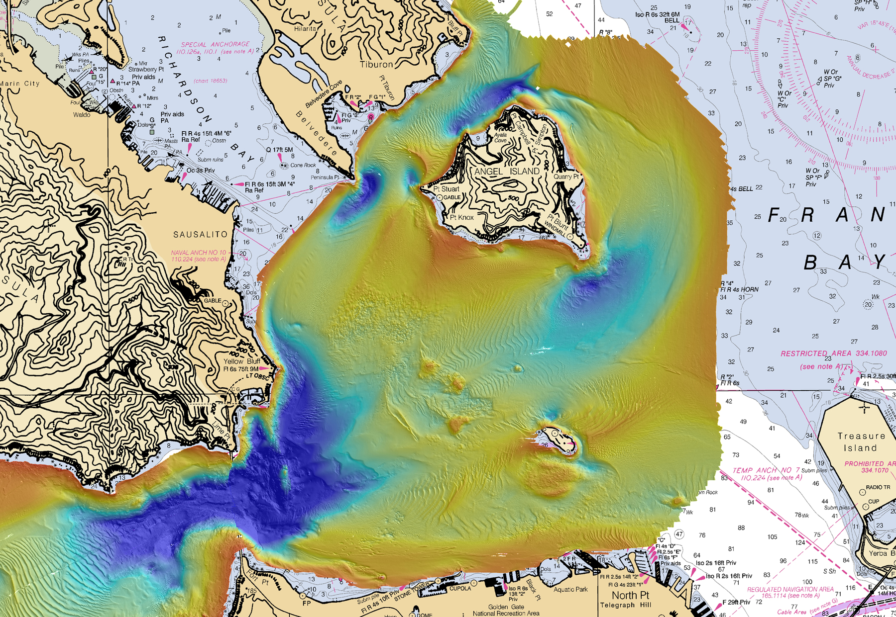
Multibeam bathymetry mapping of west San Francisco Bay, including the entrance under the Golden Gate Bridge, and the seafloor surrounding Angel Island and Alcatraz

Multibeam bathymetry mapping of west San Francisco Bay, including the entrance under the Golden Gate Bridge, and the seafloor surrounding Angel Island and Alcatraz
The Seafloor Mapping Lab (SFML) of California State University Monterey Bay is no longer an active research mapping program. The SFML Data Library, housing an extensive archive of multibeam bathymetry data, derived products, and metadata for coastal California, will remain publicly available through the California Undersea Imagery Archive.
The main archive of bathymetric-derived imagery of the seafloor were collected as part of the OPC-funded California Seafloor Mapping Project (CSMP) from 2007 – 2014. Multibeam sonar and backscatter imagery were used to produce high resolution maps of the seafloor from the nearshore to the state waters boundary (3 nautical miles). The SFML Data Library provides access to the bathymetry data and GIS-ready derived products, including habitat analyses. Data are grouped by survey location.
These data are NOT to be used for navigational purposes.
Click the Browse and Download Data button to preview the site list for available data.
Data Use Policy : These data are not copyrighted; however in the event that you publish or display results using any of the mapping data available on this download site, we request that you include the following acknowledgment: Data used in this study were acquired, processed, archived, and distributed by the Seafloor Mapping Lab of California State University Monterey Bay.
: If you download SFML data from this website, please drop us a line, to let us know how you are using or plan to use these data. Thank you.: While the Seafloor Mapping Lab makes these data available for public use, their use in for-profit enterprise is not authorized without the express permission of the Seafloor Mapping Lab of California State University Monterey Bay.