California Undersea Imagery Archive
Seafloor Topography
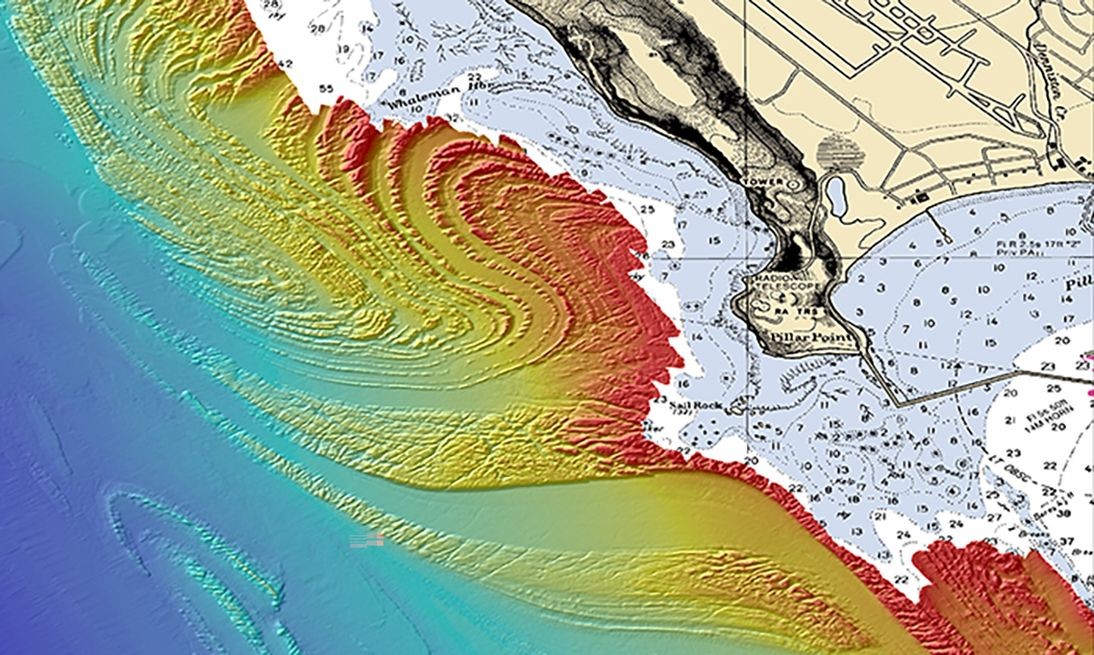
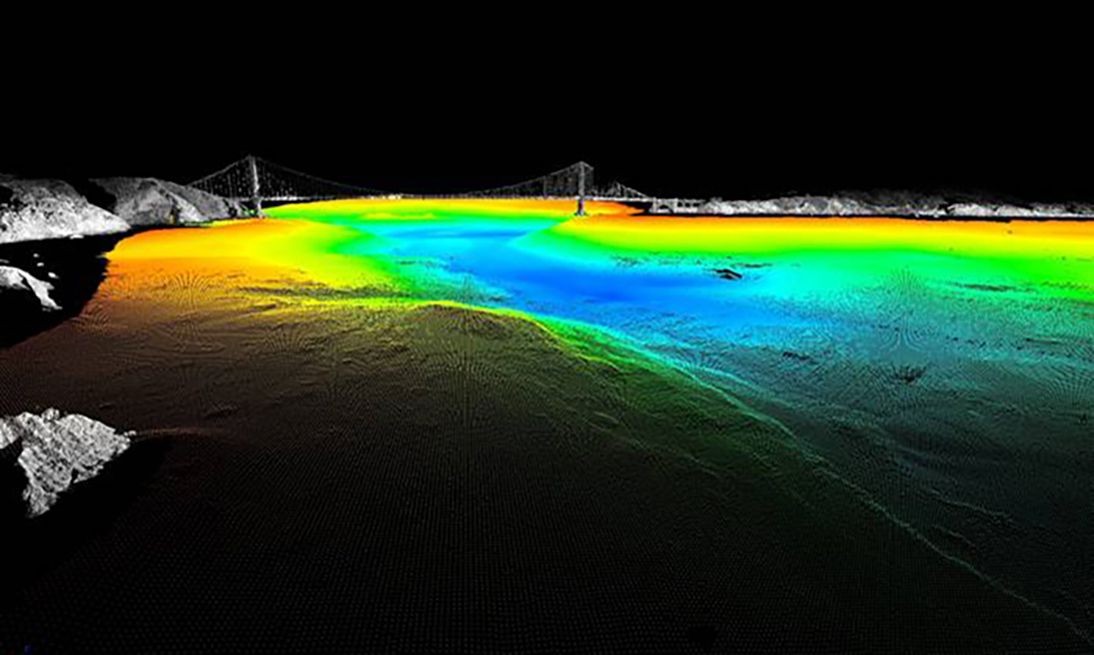
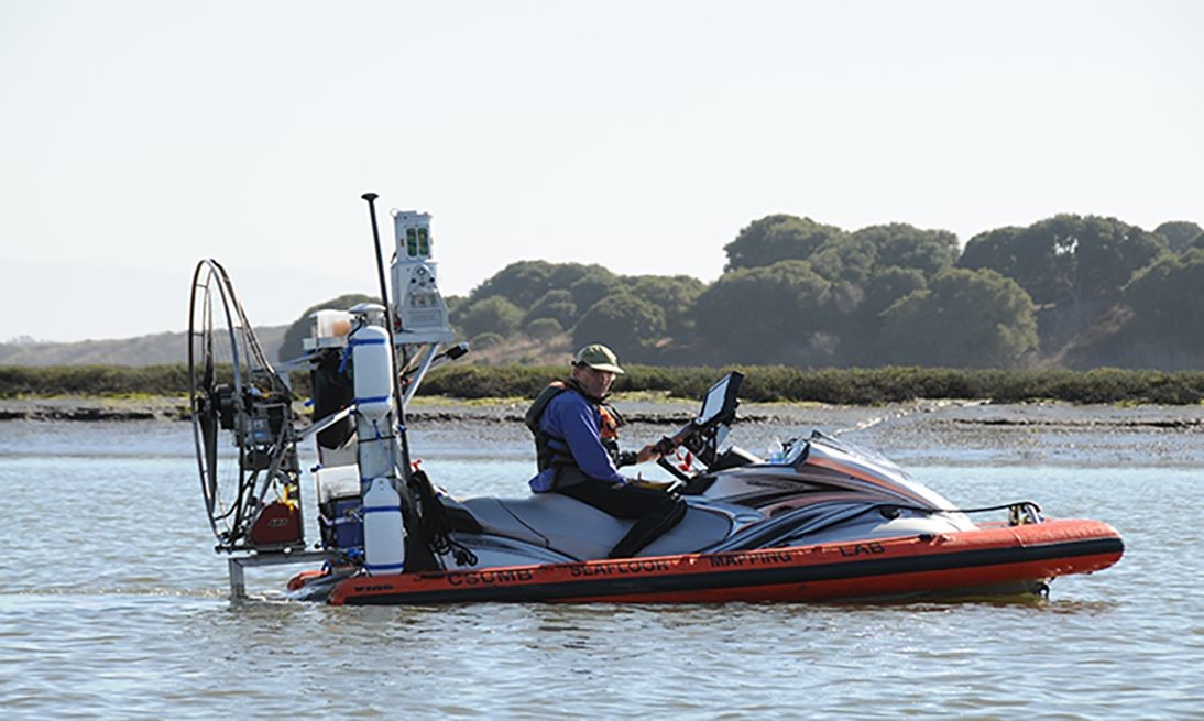
The California Undersea Imagery Archive is pleased to house the bathymetric-derived imagery of the seafloor collected, by the CSUMB Seafloor Mapping Lab (SFML), as part of the California Seafloor Mapping Project (CSMP) from 2007 – 2014. Multibeam sonar and backscatter imagery were used to produce high resolution maps of the seafloor from the nearshore to the state waters boundary (3 nautical miles).
Access to bathymetry data and GIS-ready derived products can be found via the CSMP Data Catalog. Additional SFML Legacy Data is available through the SFML Data Library portal.
**The SFML archive is off-line. Please contact cbretz@csumb.edu with all data requests. Thank you**